TerrAvion Expands Aerial Imaging Service to Florida, Helping Farms Take High-Tech Approach to Improving Yield and Revenue
/EINPresswire.com/ -- Service helps producers spot and fix problems early, before they affect crop yield
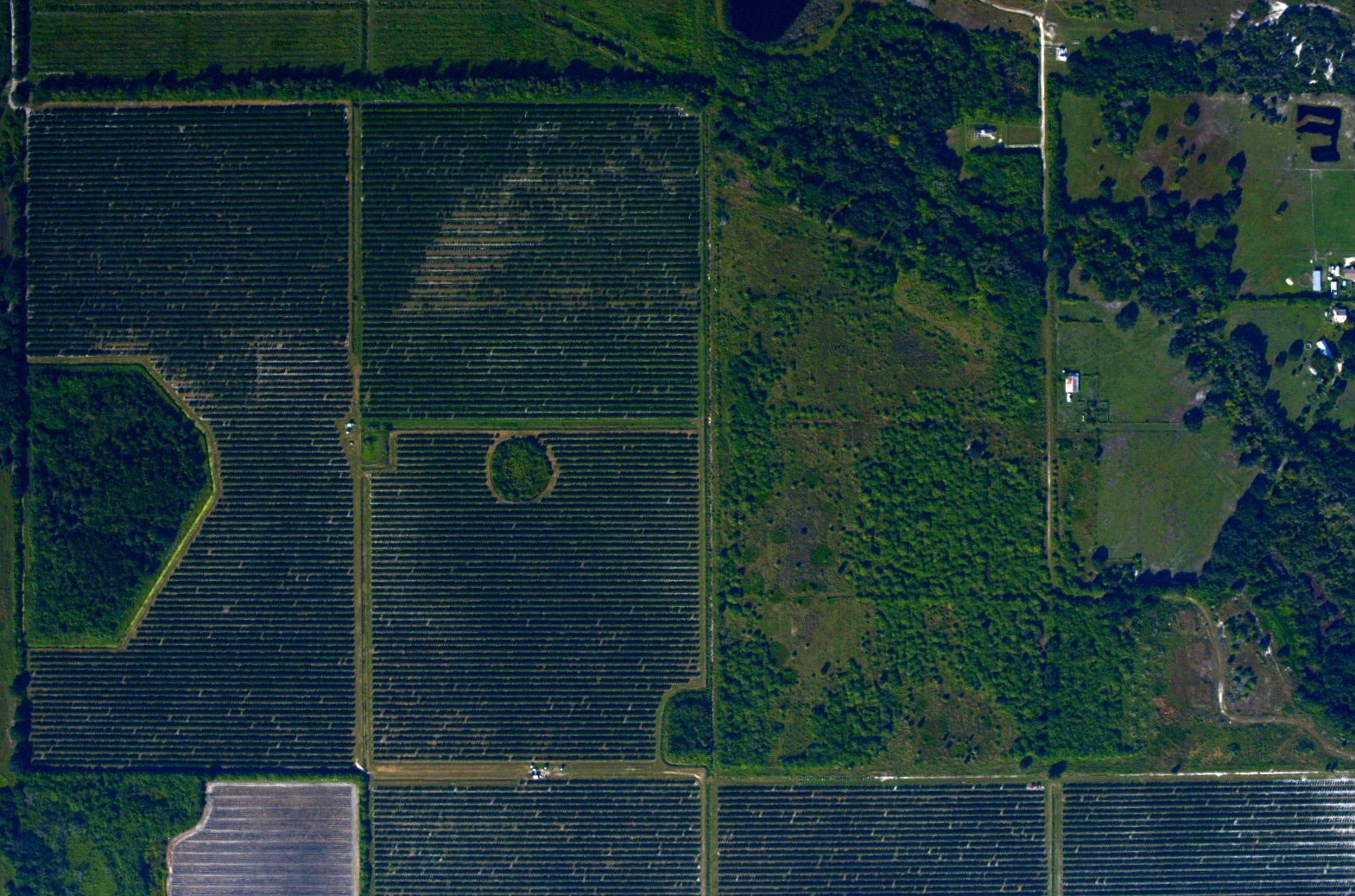
 TerrAvion, which helps farms take a high-tech approach to improving yield and revenue, announced today that it has expanded its aerial imaging service to Florida. TerrAvion provides current images and data that help growers spot early-warning signs such as irrigation problems so they can take action before emerging problems become big ones.
Click here for high-resolution version
TerrAvion, which helps farms take a high-tech approach to improving yield and revenue, announced today that it has expanded its aerial imaging service to Florida. TerrAvion provides current images and data that help growers spot early-warning signs such as irrigation problems so they can take action before emerging problems become big ones.
Click here for high-resolution version
SAN LEANDRO, CA--(Marketwired - Oct 24, 2016) - TerrAvion, which helps farms take a high-tech approach to improving yield and revenue, announced today that it has expanded its aerial imaging service to Florida, one of the nation's agricultural strongholds. Its first flights in Florida take place this week.
According to the USDA, Florida boasts 9.5M acres of farms, and is the nation's #1 producer of oranges and sugarcane. Agriculture is the #2 contributor to Florida's annual GDP (#1 being tourism); the industry employs 2 million people and contributes more than $104 billion to the state's economy each year.
TerrAvion provides current images and data that help growers spot early-warning signs such as plant health issues and irrigation problems so they can take action before emerging problems become big ones. Every week, TerrAvion takes hundreds of low-altitude flights to capture bird's-eye views of farms, and then uploads the images to the cloud within hours so growers can plan scouting, management activities and interventions with unprecedented accuracy. TerrAvion imagery is much more detailed and up-to-date than satellite imagery, and far more cost effective than drone-based services. TerrAvion customers receive not only data but also aerial photographs, NVDI images, thermal images, custom color maps and histograms, at resolutions tight enough to see individual leaves on plants.
One of the first customers in Florida to utilize TerrAvion is Highland Precision Ag, which offers a suite of precision agriculture products and services that assist growers in reaching their management and production goals. Founder Steve Maxwell said, "There are great products in the Precision Ag market that can really help our customers increase yield while reducing inputs. The cornerstone to our program is high-quality imagery. TerrAvion's expansion to Florida has made these products affordable for even the smallest of growers. TerrAvion's nationwide footprint has allowed us to expand to all of our customer base, coast to coast."
TerrAvion's founder, Robert Morris, a former U.S. Army drone platoon leader, said the company decided to expand into Florida due to high demand from companies like Highland Precision Ag and Propak, makers of Citrus Pro. "There's a huge grower community in Florida, and they are very tech savvy and open to trying new things," said Morris. "We are seeing strong interest from growers all across the state."
To learn more about TerrAvion's services, visit www.terravion.com.
About TerrAvion
TerrAvion helps farms take a high-tech approach to improving yield and revenue, with the first cloud-based aerial imaging and data analytics service for agriculture. TerrAvion provides growers from small family farms to the largest agribusinesses with current images and data that accurately detail the conditions of every acre, helping identify problems early before they impact yield. Founded in 2013, TerrAvion's investors include Y Combinator and FundersClub. For more information, visit www.terravion.com or follow @TerrAvion.
Image Available: http://www2.marketwire.com/mw/frame_mw?attachid=3071127
Contact:
Michelle Faulkner
Email Contact
617-510-6998